Global South, the beginning of everything.

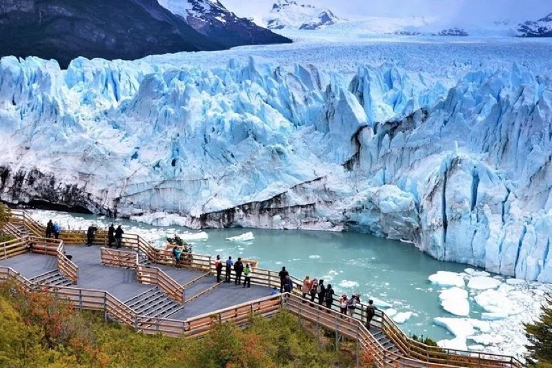
In southwestern Santa Cruz, on the shores of Lago Argentino, El Calafate is the gateway to Los Glaciares National Park and the Perito Moreno Glacier — one of the most astonishing natural phenomena on the planet. Here the ice does not retreat: it advances, creaks, collapses. And the traveler who sees it, legend says, always comes back.
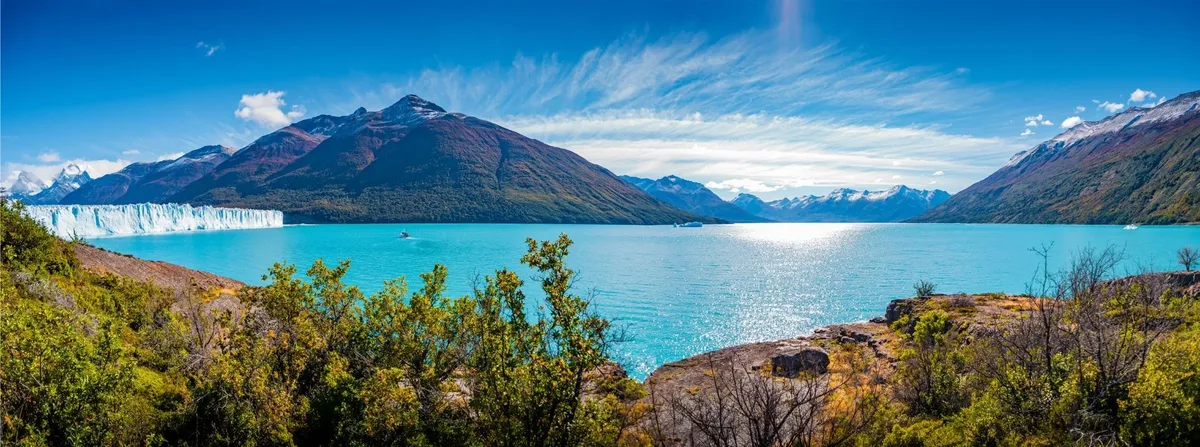
Lago Argentino with calafate bushes in the foreground and the blue wall of the glacier in the distance. The image that gives everything its name.
The name comes from a berry. The calafate (Berberis heterophylla) is a thorny shrub that grows on the Patagonian steppe between latitudes 40° and 55° south. Its fruits are small, bluish-violet, slightly bitter and highly aromatic. The Aonikenk communities — the southern Tehuelche — gathered and ate them since time immemorial, both fresh and fermented into chicha. Nomadic guanaco hunters, they knew every corner of this steppe long before any European arrived. There is a legend with a great deal of biological truth to it: "whoever eats calafate always returns to Patagonia." The birds that eat the berries carry the seeds, drop them in other territories and come back. The human traveler, they say, is not so different.
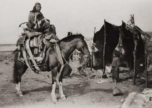
The Aonikenk — the southern Tehuelche — roamed this steppe for millennia before the arrival of Europeans. Historical photograph, late 19th century.
Francisco Pascasio Moreno was the man who put Patagonia on the map — and he should not be confused with the glacier that bears his name. A self-taught naturalist and explorer from Buenos Aires, he first came south at age 24. In 1877 he navigated the Río Negro by canoe. In 1879 he became the first man of science to survey Lago Argentino in a small wooden boat, reaching the arms of the lake where icebergs calved from the glaciers float today. He received the title of "Perito" — expert — because he represented Argentina in the 1902 boundary arbitration with Chile, the process that fixed the Patagonian border as it exists today. The Perito Moreno Glacier bears his name although, paradoxically, Moreno never saw it. In recognition of his services, the Argentine government offered him 25 square leagues of Patagonian land. He accepted them — and then donated them to the State. That land is today the core of Nahuel Huapi National Park.
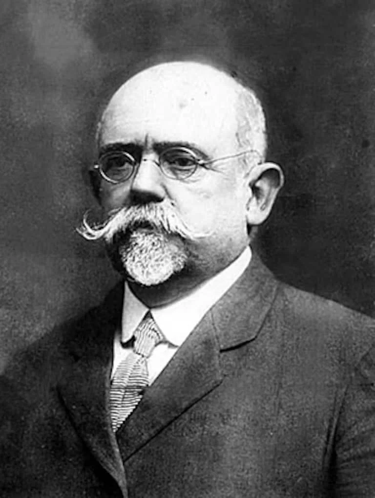
Francisco Pascasio Moreno
(1852–1919)
Moreno explored Lago Argentino in 1879 in a wooden boat. The glacier that carries his name today was christened in his honor — although he never got to see it. For his contributions to the country he was offered land in Patagonia: he accepted it and then donated it to the State to create Nahuel Huapi National Park. A gesture that says a lot about who this man was.
The town took decades to grow. In the early 20th century the area was sheep-ranching country. The first settlers arrived on the shores of Lago Argentino between 1900 and 1910, drawn by public land. The town took shape around 1927, with a police station, a school and a general store. For decades it was barely a dot on the map. Everything changed in 1937, when President Agustín Justo signed the decree creating Los Glaciares National Park: 726,927 hectares of ice, native forest and mountains declared a natural reserve. The first walkways facing the glacier were built in the 1980s. The current airport, which today receives flights from Buenos Aires in just over three hours, opened in 2000. El Calafate now has more than 25,000 permanent residents and close to 800,000 visitors a year.
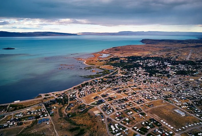
El Calafate from the air: the town spreads across the steppe between Route 40 and Lago Argentino. On the horizon, the mountain range where the glaciers are born.
Endless days — in January the sun doesn't set until 10:30 PM. More flights and more excursions. More tourists and higher prices. Book ahead, especially the mini-trekking.
Affordable prices, almost no crowds and the chance to see the glacier with fresh snow over the blue ice. Some services scale back. The glacier is always there — it never closes.
The sweet spot: fewer tourists than in summer, almost every service running and mid-range prices. Lago Argentino starts to show its most vibrant colors as winter fades.
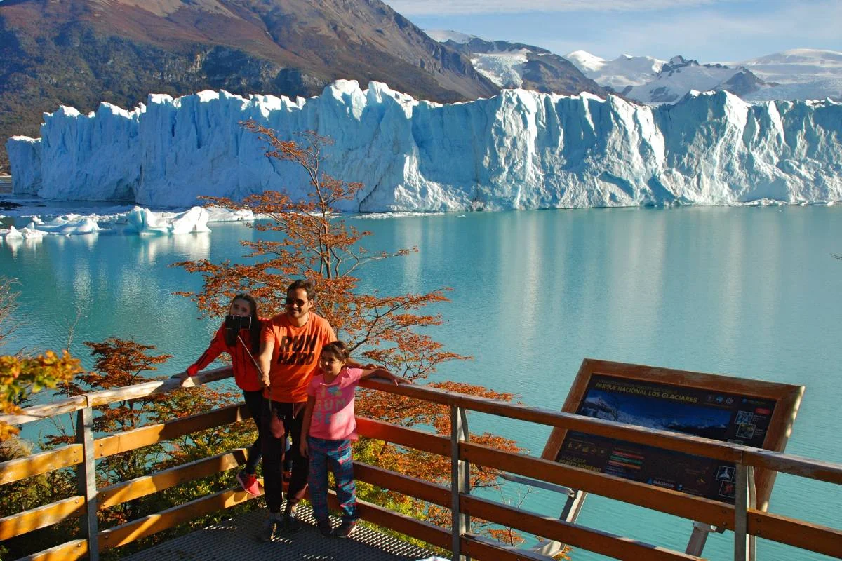
In autumn (March–May) the crowds thin out and the color turns up: the lenga trees blaze red with the glacier as a backdrop. The least known — and prettiest — season.
Comandante Armando Tola International Airport (FTE) is 23 km from downtown. Direct flights from Buenos Aires (Aeroparque and Ezeiza, ~3h 15min), Bariloche and Ushuaia. Aerolíneas Argentinas and LADE operate the route. Shared airport transfer: between USD 8 and 12 per person.
From Río Gallegos: 320 km on National Route 40 (3 hours). From El Chaltén: 230 km on Routes 40 and 23 (2h 15min). From Puerto Natales, Chile: 340 km including the border crossing (3h 30min). The entire route is paved.
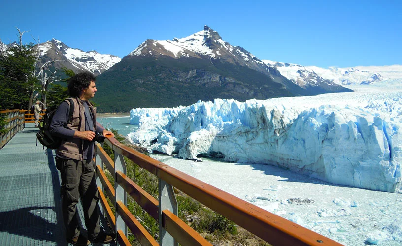
80 km from town, inside Los Glaciares National Park. The glacier has a 5 km front, is 30 km long and rises up to 60 meters above the lake. It is one of the few glaciers in the world that is not retreating: it advances 1 to 2 meters per day and sheds mass from its front in dynamic equilibrium. The calvings — building-sized blocks of ice crashing into the lake with a roar — are constant. The walkways let you watch it from different heights and angles. Set aside at least 3 hours. The morning light on the blue ice is infinitely better than midday light.
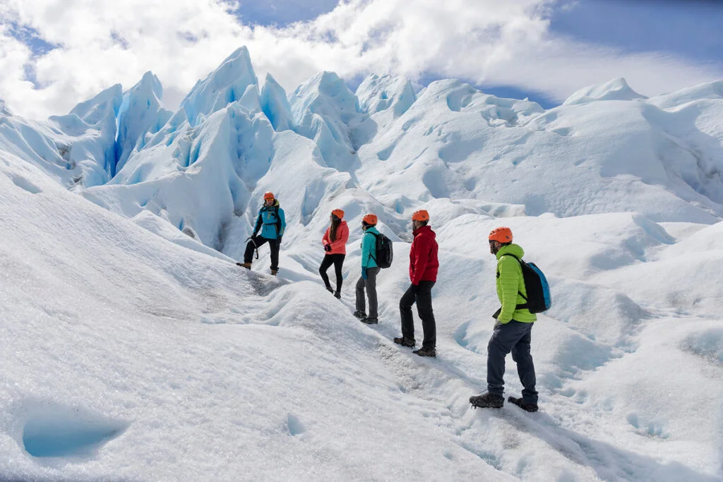
The most intense experience El Calafate offers. You cross by boat to the southern side of the glacier, strap on crampons and walk roughly 90 minutes on the ice. Standing on the glacier, listening to it creak from within and seeing the crevasses and blue ice caves up close has no equivalent. The physical effort is moderate — suitable for most people without special training. It can only be booked through licensed operators; the best known is Hielo y Aventura.
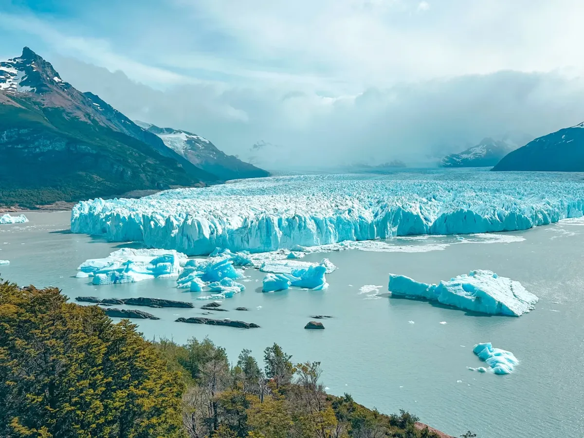
This excursion sails the northern and southern arms of Lago Argentino, passing the Upsala Glacier — much larger than Perito Moreno but in accelerated retreat — and the Spegazzini Glacier, the tallest in the park with a 135-meter vertical front. The trip takes about 8 hours and includes lunch on board. It is the only way to see these glaciers and the floating icebergs they generate. It departs from Puerto Bajo de Las Sombras, 50 km from town by road.
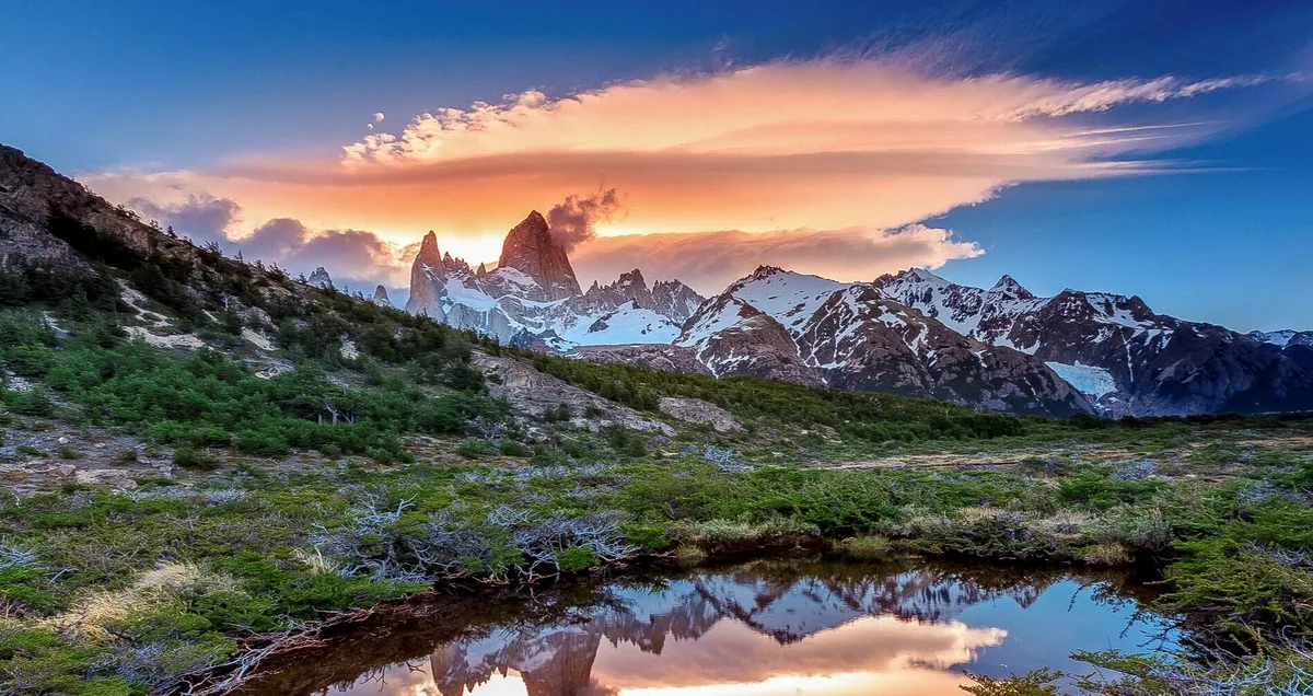
230 km up Route 40, El Chaltén is the trekking capital of Patagonia and Argentina's youngest town (founded in 1985). Fitz Roy and Cerro Torre are two of the most photogenic summits on the planet. El Calafate agencies offer full-day excursions departing at 7 AM — enough time to hike the trail to the Fitz Roy viewpoint. If you can stay overnight in El Chaltén, even better.
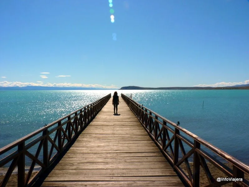
A nature reserve 15 minutes on foot from downtown, on the shores of Lago Argentino. It has a wooden boardwalk and is one of the best places in Patagonia to watch pink flamingos — in season they gather by the hundreds. The scenery combines the enormous lake, the flamingos and the snow-capped mountains behind. Cheap entry, no guide needed. Perfect for your first afternoon in town, especially at sunset when the light turns golden and the flamingos flock over the water.
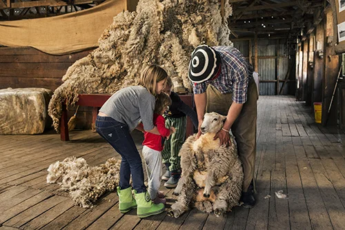
For your last morning before the flight, half a day at an estancia is the perfect end to the trip. Estancia Alta Vista (33 km from town) and Estancia Nibepo Aike (57 km, inside the National Park) offer horseback rides, Patagonian wildlife watching, sheep shearing in season and a lunch of spit-roasted lamb. Shearing is one of the oldest rituals of ranching Patagonia — an expert gaucho can shear a whole sheep in under two minutes. Outside high season there is no need to book far in advance.
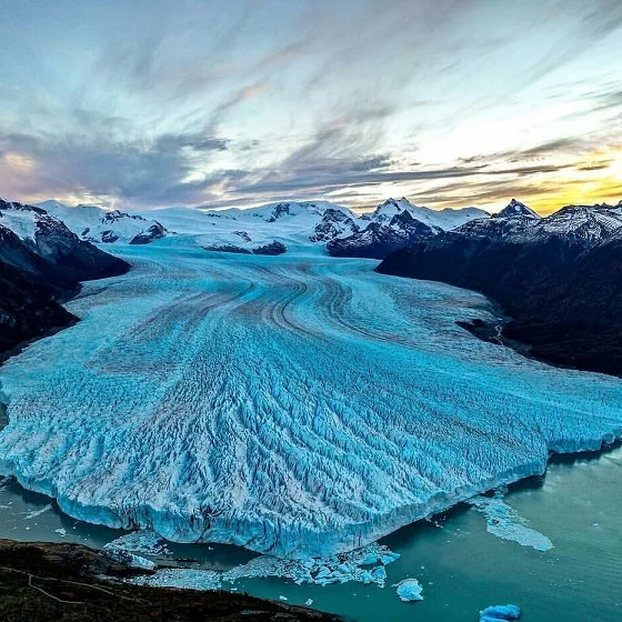
The Perito Moreno Glacier from the air at sunset: 30 km of ice advancing toward the lake from the heights of the Andes.
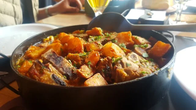
The town's historic go-to grill. Spit-roasted lamb and Patagonian ribs, slow-cooked over embers. Family atmosphere, generous portions. Reservations essential in high season.
The most complete restaurant downtown. Lago Argentino trout, braised lamb, calafate-berry empanadas. A well-curated list of Patagonian wines. A solid choice for any night.
Casual and budget-friendly. Homemade pastas, short-order dishes and simple lamb preparations. The best value in town for a quick lunch between excursions.
The freshest option: big salads, wraps, vegetarian dishes and natural juices. A break from the meat after three days of lamb and trout.
Sweet and savory crêpes and sandwiches. Ideal for breakfast or an afternoon snack after the glacier. Relaxed vibe, quality coffee and the best spot to plan your day.
The most legendary bar in town. Antarctic-expedition décor, a great whisky selection and the best lake view of any bar around. To end the night in polar style.
Oak-topped bars and up to twelve rotating taps of house-brewed beer. The best picks are the Negra and the seasonal Stout. They also serve thick-crust pizzas and Patagonian sharing boards, perfect after a trek.